ProjectProposal-juanpadilla
From CS 160 Fall 2008
Contents |
Target User Group
The target group for this project is elementary school children (k-5) and teachers who are trying to learn/teach geography. However, the scope can be broadened to a much larger group of people as the game could/should have various levels of difficulty depending on skill/education level, which could be used for more advanced groups such as high school students and adults.
Problem Description
With increasing globalization of money markets, trade, jobs and pretty much most things, it is becoming more important than ever to have a sense of where regions or countries are in the world. The problem is, most people have a difficult time navigating their way around a map and moreover many of them have a hard time giving a relative position, with respect to neighboring places, when asked where a specific place is located.
Problem Context and Forces
This is due, in part, to the fact that learning geography can be boring and tedious because of the lackluster tools and arcane teaching methods still being used in most schools, so it is hard to keep a child’s attention for a long enough period of time for them to learn properly. Furthermore, budget cuts and a greater focus on standardized tests have forced teachers to teach with a goal of educating students about what is on the test, leaving little time to emphasize other, what are often viewed as “less important” skills. As a result, an inexpensive, more efficient, interactive process of educating children about geography is necessary to increase awareness about their global neighbors.
Solution Sketch
An interactive geography game…
The game will contain multiple views
- World view
- Pertaining to the globe as a whole
- Pertaining to the globe as a whole
- Local views
- Such as country level views that would outline states or provinces.
- Such as country level views that would outline states or provinces.
The key to the game is its interactivity. For example, the game will contain fun facts and questions like:
- What country produces the largest amount of corn in the world?
- What US state contains the highest peak in North America?
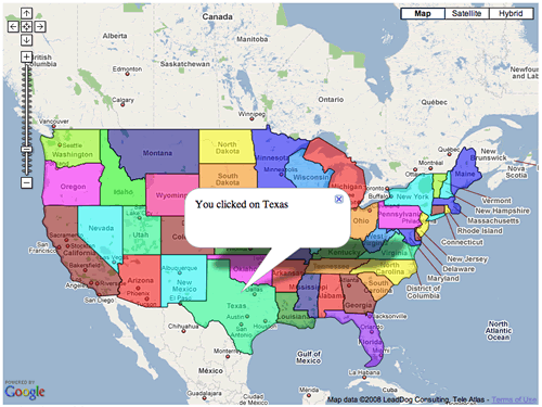
The student would then click a location on the map at the desired location, which would provide either a hint or congratulations for choosing the correct location. Furthermore, a link providing more local information containing say, pictures or other types of interactive info about that region could then be provided.
Scavenger hunt mode…
- What are the modern locations of the Seven Wonders of the World?

figure 1: source http://econym.googlepages.com/example_states.htm
